Wednesday, November 19, 2014

492 Miles of Awesome - from Ridgway State Park to the North Rim of Grand Canyon - Day 6 - September 20, 2014

There is something really great about cooking breakfast while camping. The percolating coffee smells about 1,000 times better than any coffee you've ever made at home, and any food you might have in the cooler can be deemed breakfast worthy. This morning we had our first experience with the miracle of Juustoleipa, otherwise known as bread cheese. It's a cheese that the Finnish have apparently been making for over 200 years...keeping the secret safe, I guess.  Whole Foods in Colorado Springs had this in the cheese bin, and the package explained that it could be grilled easily. We cut up slices and included them in the cast iron pan, along with the Black Forest Bacon, two eggs, and we had our first delicious camp breakfast. All this stuff is not on my list of lower cholesterol foods, but ... bread cheese!  Seriously, this stuff is so good, simply sliced up and put right on the pan. I hope our Whole Foods has some.

We had such a great day the day before. Perfect weather, not too hot, lots of sun and blue sky, and spectacular views!  It was hard to leave the Ridgway after just one night. We loved it there, but we hoped to be in the Grand Canyon on the North Rim on this night. It was good that we had reservations in the camp ground there, so we could relax knowing that there would be a place for us no matter when we arrived.

I cannot remember what view this is, but I think it is just as you are heading into Utah from Colorado at the border near Dove Creek. The landscape is unreal. Flat, wide open spaces, wind, and heat.

We set out on Route 62 from Ridgway, and connected with 145 up to Naturita, passing over the Dallas Divide into Placerville, up to Norwood, and Redvale. Just as we were turning onto 141 S in Naturita, we passed a pickup truck on the side of the road with a banner saying they had sweet corn. Jeff jumped out of the car, barefoot and disheveled, and the farmer, a man of Mexican decent with a beautiful gold tooth, and a weathered, kind face, wondered out loud to Jeff if he had any shoes to wear.  We only wanted a couple ears of the corn, but he insisted that we take at least six. In the end, we were glad we did. One of our favorite things is roasting corn in the husk right in the coals of the fire. It caramelizes the corn, making it even sweeter. The corn looked suspect to us, and we were thinking "cow corn" because of the size of the ears. 


The following two photos are from the Gypsum Gap just outside of Slick Rock, Colorado. There isn't much information on-line about the Gypsum Gap area. A search results in only  publications about the Gypsum Gap Geologic Quadrangle, and some very cool topographic maps for sale. I hoped to find out more, but there isn't even a Wikipedia page. Weird. Apparently there is a good hike to the Gypsum Gap Rock Shelter, though. It's beautiful through here, and after you cross the pass at 6,100ft. you cross the Dolores River. 


141 brings you down into Dove Creek, CO, just on the border of Utah, where we got onto 491 crossing the state line, bringing us into Monticello. This brings you by the Manti-La Sal National Forest, were you can see both Abajo Peak, at 11,360ft, and  Mt. Linnaeus at 10,961ft. The Devils Canyon is here as well, which looks amazing, but we didn't get a chance to check it out. In the future, we have plans to come back to Utah and spend at least two weeks exploring.  

In Monticello, we connected with 191S into Blanding and continued onto 163, to Bluff at the Navajo Twin Rocks all the way to the border of the Navajo Nation at the junction of 261 and 163. This is where you cross the San Juan River, which forms the northern border of the Navajo Nation, and here we saw Mexican Hat.  It's one of those formations that just can't be believed!  The flat rock on top is nearly 60 feet in diameter. It might look small in these photos, but that's the length of our house... 60 feet.  That's our house, balancing on top of a rock up there!


Spanning between Utah and Arizona here on 163, you pass through Monument Valley.  "Monument Valley is like a national park, but falls within the jurisdiction of the Navajo Nation's 27,425 square mile territory in the four Corners region of the United Sates. Of that 17 million acres, more than 91,000 acres are set aside (in 1959) as Monument Valley Tribal Park, a space larger than Arches National Park".  Find out more about the Navajo Nation Tribal Parks here on their website. 

A photo from inside the car on rout 163. The expanse is intense! It was about 95 degrees in the valley, and dry. In the Northeast, we do not experience this kind of dry ever! 


Somewhere along 163, and sadly we didn't get any photos, or note exactly where it happened, but as we were driving along we noticed way off in the distance what looked like a small airplane on the ground. Was there a small airport nearby, like Northampton airport? We hadn't seen many little planes on our travels so far. As we approached, it became clear the the plane was ON the road! The plane had landed on the road and was facing towards us. Now we started to slow down, approaching with some caution, not knowing what was going on. The plane maneuvered to the left, and was sideways across the road and shouldered onto the grassy terrain to the side of the road. I guess we were stunned. We didn't get out our cameras, or our phones to take photos...mostly because we were trying to figure out what had happened.  There were power lines just up the road, and obviously the plane had had to navigate its way through these and onto the road. As we drove away, we passed several police cars heading in the direction of the plane. A Google search does not turn up any news about the plane on the road, and we don't know which police station responded to the incident, so we have no information on what happened. At least it wasn't a crash. We suspect it that had been flying over the Grand Canyon, and either ran out of gas, or had engine trouble, so they set down in the safest spot they could see. 

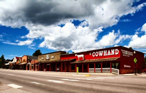
Continuing on 163, you come into Kayenta, Arizona, meeting up with 160 which goes through Black Mesa, Cow Springs, Red Lake, into Tuba City. At Tuba City, we jumped on 89 N, which is the only way to get up to the North Rim of the Grand Canyon. First though, you travel through miles of spectacular landscapes, Cedar Ridge, Bitter Springs, Marble Canyon on the left. This is all still part of the Navajo Nation, which covers over 27,000 square miles in the states of Utah, Arizona, and New Mexico. The population is over 250,000. The roads which brought us through this area didn't reveal a lot of homes, or centers, but we did see a lot of small stands on the sides of the roads, especially on the Navajo Bridge, where local people were selling their pottery and jewelry to tourists. This part of 160 also brings you by the upper Northwest corner of the Hopi reservation, situated inside the Navajo Nation land. More information can be found about the 20 Tribal nations found in Arizona on the Inter Tribal Council of Arizona, Inc. (ITCA) website. 


The Navajo Bridge crosses the Colorado River at Glen Canyon National Recreation Area.  All along the right side of Alt.89, after you pass over the Bridge are the Vermillion Cliffs. This was one of my favorite places, and surprisingly we didn't take a lot of photos along here. Mostly because you hold up the camera and discover that it just can't capture how it really looks, not to mention how it feels as well. 

In the photo below you can see the Vermillion Cliffs in the background. There are miles of these cliffs as you drive up towards the Kaibab National Forest. Check out this gallery on National Geographic, for more photos! You could spend a week, or more, here exploring the landscape. 


 This is the Colorado River, from the Navajo Bridge, facing North toward Utah

And here, the incline starting up into Kaibab, with a view down to the Vermillion Cliffs. 

storm was setting in as we headed into the Kaibab National Forest, and small periods of rain and thunder. The drive through this area is very beautiful. The road starts heading upwards, so you are climbing as you head towards the Canyon area, and the landscape starts to change again.  There were signs that told you to be cautious because a fire was currently burning through the area. We saw small patches of smokey areas as we headed up through the forest. There were also signs warning of free range cattle crossing roads, which we saw as we entered the Grand Canyon area, giant black cows crossing the road in groups. 

We stopped and found some butter for the corn at Jacob Lake Inn, just at the intersection of 89 and 67 which takes you right into the North Rim of the Grand Canyon.


At this point, we passed a really sad looking bicyclist, waving a dislocated tire, and obviously trying to get a ride. We stopped, not imagining that we'd be able to fit another person, never mind a bicycle, into our completely packed car. His name was Paul, and he had two flat tires on his bike, a hopeless situation, and completely dependent on getting a ride back to his camper parked on the side of the road, at least 15 miles away. After a lot of shifting, and rearranging, we managed to pack him, and his bike, into the back of the car. Turns out he was working at the Grand Canyon in the accounting department, which sounds totally boring, but look where he was on Saturday afternoon! He invited us to come for dinner with him at the employee cafeteria, if we were hungry. Such a nice guy. We declined his offer, knowing that the sun was quickly setting and we wanted find our site and get our tent set up.

On the way up we saw lots of mule deer and a large herd of bison, in the various meadows that line the side of the road up to the park.

I'm pretty sure we were in Site #48 in the North Rim Campground. It was $18 for a night and the ranger station was thankfully open when we arrived after dark. We did get a little lost trying to find the campground, and walked up to the main lodge to try to get directions. The lodge was what you'd expect. A giant, stone and wood structure, with a restaurant, and views of the canyon from inside. We didn't spend too much time inside, as it was getting dark. I took the next two images from the North Rim Grand Canyon website.


So, we didn't get to see much of the scenery when we arrived, due to darkness, and rain. The thunder / lightning storm that we drove through coming into the park was just fizzing out as we were setting up our tent.  After quickly setting up, we had several glasses of wine and cooked our corn in the coals of a nice fire. It was an uneventful night of camping and I think we were so tired that I was asleep before touching the pillow. 

And we traveled 492 miles this day!  Seemed like a breeze. I hope to mention in the next post, that we had started listening to a book on CD, WAY back in West Virginia. It was John Steinbeck's Travels with Charley in Search of America. Read by Gary Sinise. 


Thursday, November 13, 2014

A good day for Second Breakfasts - Day 5 - into the lonely mountains - September 19

The previous night is a blur, really. Our gracious host, and I can't for the life of me, remember his name... David, Ron, Ray... filled champagne glasses with yogurt and fresh fruit, and made us omelets with pesto and vegetables. Hungry and tired, we couldn't resist eating, even though we had plans for breakfast with a good friend this morning.  

For a few years, I've been corresponding with a customer of mine from Colorado. Ute's house must be a Btaylor Quilts showcase!  She is my best customer, and over the years has become a friend as well. One of the best things about having my shop on Etsy is the fact that I've gotten to know some really great people, albeit mostly on-line, but still, I've made some significant connections since I joined in 2007. The first time I "met" Ute was in July of 2012 (her name is pronounced "oooo-tuh"- so, as in "ooooo - that sunset is beautiful", and "tuh" "oooo-tuh!!).  In 2012, she found my Kimono quilts and purchased two of them, and we've had a steady correspondence since then. 


Plans were made to finally meet Ute well before we left on this journey!  She had picked out a restaurant in Woodland Park.  The Hungry Bear was busy, and with good reason. The decor and food was just what you'd expect when thinking about Colorado, the mountains, forests, aspen trees, and wide open skies. It was cozy-cabin-home-cooked wonderfulness, and we enjoyed a hearty, second breakfast!  I was excited to finally meet Ute, it's weird to have a relationship with someone for so long, who you've never met in real life, and then suddenly they are before you, hugging you!  Weird, but totally wonderful! She had hand knit for us the most beautiful scarf and cowl. For Jeff, an exquisitely soft blue scarf knitted from German wool, and for me, a red-toned, very warm cowl of soft wool! She had also made us a card with an image from Garden of the Gods , which she encouraged us to go see. We were on a schedule and didn't have the time that day. There are definite plans to come back to CO in the near future!  Mostly because I totally forgot to get a photograph of me and Ute!!  HOW could I have forgotten to do this?!  

I know Ute is going to read this. So Ute, don't be embarrassed!  Both Jeff and I were so happy and lucky to meet you. Thank you for the fabulous gifts and for being so awesome and kind. Many many hugs to you! And next time, you'll have to suffer through photos :)


Beautiful, beautiful Colorado, from a rest stop in Salida, looking West, towards the mountains: Antero, Princeton, Mt. Harvard, Monarch Pass, and Tomichi Dome.  This rest area is just above the town of Buena Vista, which you can see in the valley below. It's right where 24/285 and 304N meet. This is one of the most picturesque views we encountered on our trip. 


The flora and fauna have changed as we've traveled. Today we saw pronghorn antelope on the way out of the Rockies and into Utah. It is becoming drier and more desert-like.
Aspens in bloom

Passing over the Continental Divide through Monarch Pass. I walked from this spot up a small incline to the visitor center and market. Being from near sea level New England is quite evident when you start walking up inclines at 11,312 feet! I was kind of gasping for air by the time I got up to the store, lungs squeezed, and I could feel my heartbeat in my head. The drive up through the Pass is very thrilling. See all the Miatas in the photo below, surrounding the sign? A group of them, maybe 40 or so...not sure, I didn't count. They were zooming around through the mountains. We saw them from time to time as we stopped along the way. They were a bit annoying, honking their horns, and being idiots passing trucks on less than ideal corners. We also saw many, many bikers on their Harleys and BMW's, tooling around through the mountainscapes. Having ridden a Harley for the last eight years or so, I've actually got NO desire any more to ride a motorcycle across the country. It was hard enough in a car. The stress of the curves, inclines, hair-pins, etc. would be exhausting, not to mention the other cars, campers, trucks to deal with.  Although, I guess if I was given five months and a support van/camper to follow me, I'd do it :)

Continuing on 50 and through the most southern part of the San Isabel National Forest and Gunnison National Forest, you pass through Sapinero, Cimarron, and finally into Montrose.  Along the way we encountered the Dillon Pinnacles, in Gunnison, CO. There are a ton of hiking trails here, and it's so beautifully quiet. 

Jumping on 550 South, it was starting to get to the point where we'd have to decide where to stay for the night. Originally, we had planned to head more west from Colorado Springs, up into Utah to Moab, and find camping at either Arches National Park, or Canyonlands NP. We were running so late, that we decided to cut off the whole of Northern Utah, and just start heading directly south to Grand Canyon.  So, we no idea where we'd camp. There are a ton of campgrounds in this general area! There was a campground called Ampitheater in the Uncompahgre National Forest that we thought might be a good stopping point, but passing down 550, we spotted Ridgway State Park.  It didn't look like much from the road, but it was nearing 5:30 and we thought we'd call it an early day. Given we hadn't camped yet, we'd be struggling with finding everything and first set up, etc., so we thought we'd check it out. 

As you can see, we were SO happy that we did. This was the view from our tent, and these photos can hardly do the scene justice. The clouds were like mountains, and the air was full of all kinds of birds; magpies, stellar jays, ducks and geese wheeling below across the top of the Ridgway Reservoir. It's no wonder they call this area the "Switzerland of America".  I'm pretty sure we were in campsite 151 in the Elkridge tent only section. Of course, we took a ton of photos.  The night was dark and perfect for star gazing, and cooking food on the fire. We brought along a nice, little cast iron pan, and cooked up some of the hot dogs from Whole Foods, and put them in some little tortillas with cheese! Our friend Christophe, had given us some really cool wine cups for camping, so we broke these out for the first time on our trip, and enjoyed wine with the stars.  Maybe not gourmet, but much better than Pringles and Cokes.